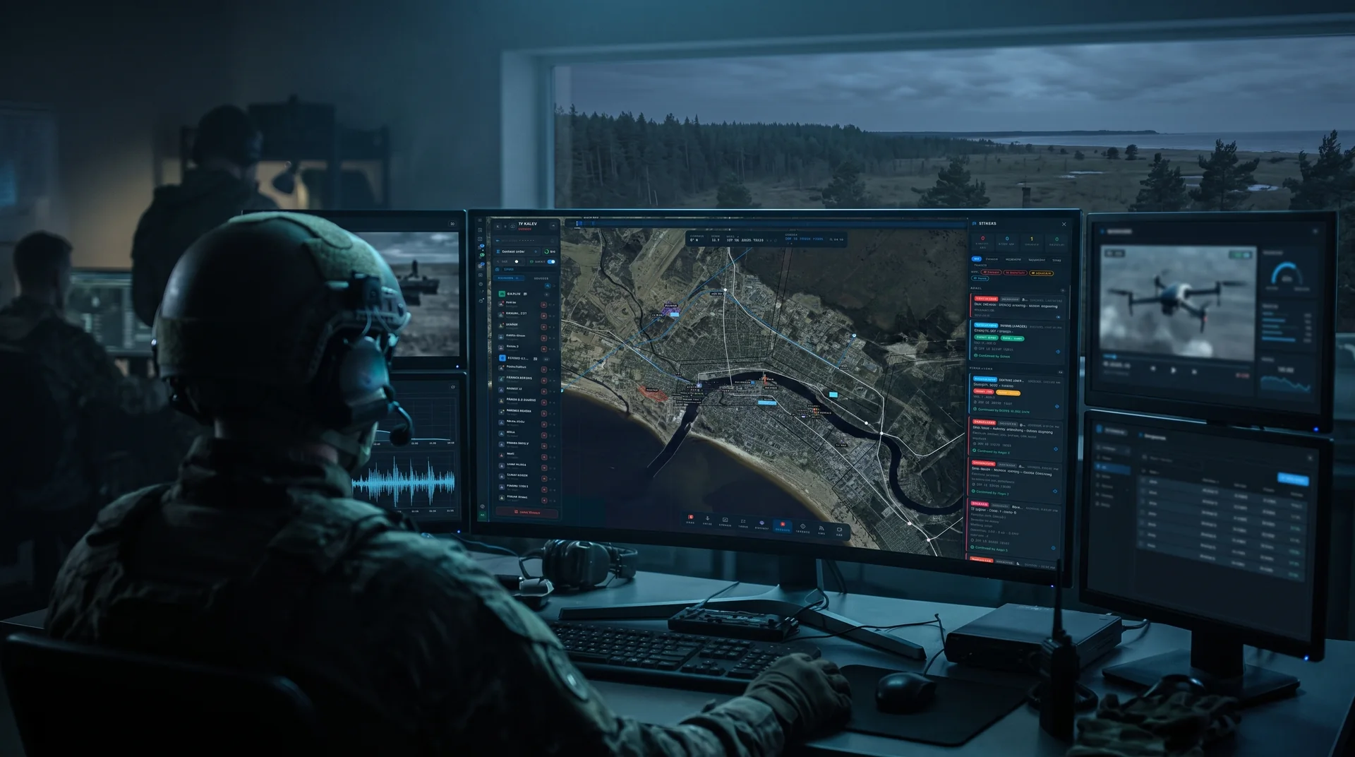
Operator viewing the ESTAK operational map

The operational picture

One platform.
Every mission.

ESTAK brings teams, maps, communications and field data into one shared operational picture.

From information
to action

One operational picture

Everything your operation needs.

Scroll or choose a capability. Open any screen for a closer look.

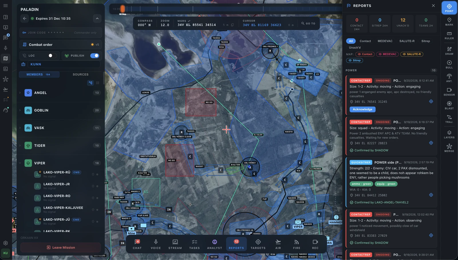
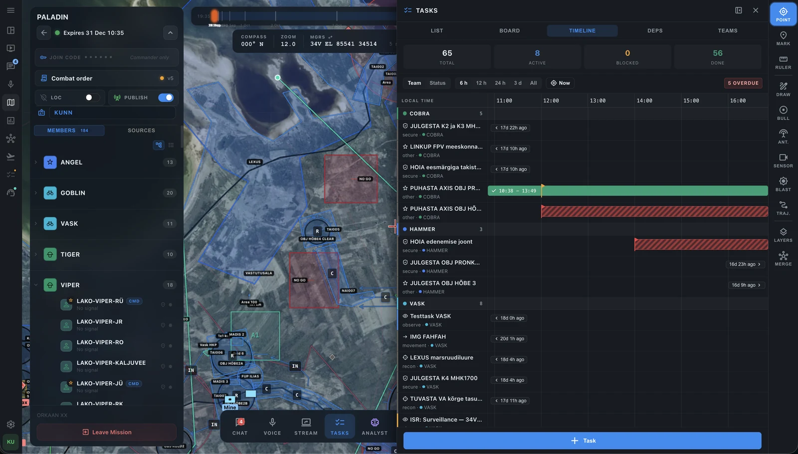
Actual ESTAK Live Map interface with teams, operational graphics and reports
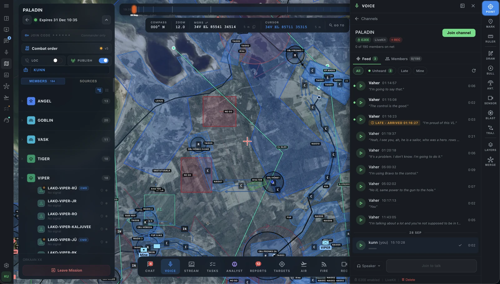
Actual ESTAK web voice channel and recorded voice messages
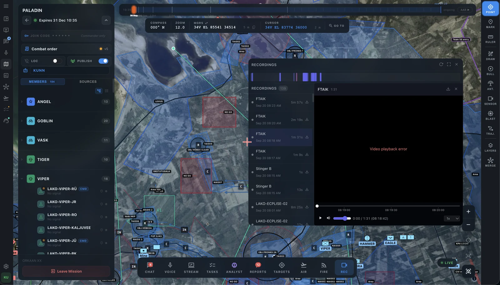
Actual ESTAK video interface with UAV recording playback over the operational map
Actual ESTAK Tasks interface showing team assignments and the task timeline beside the operational map
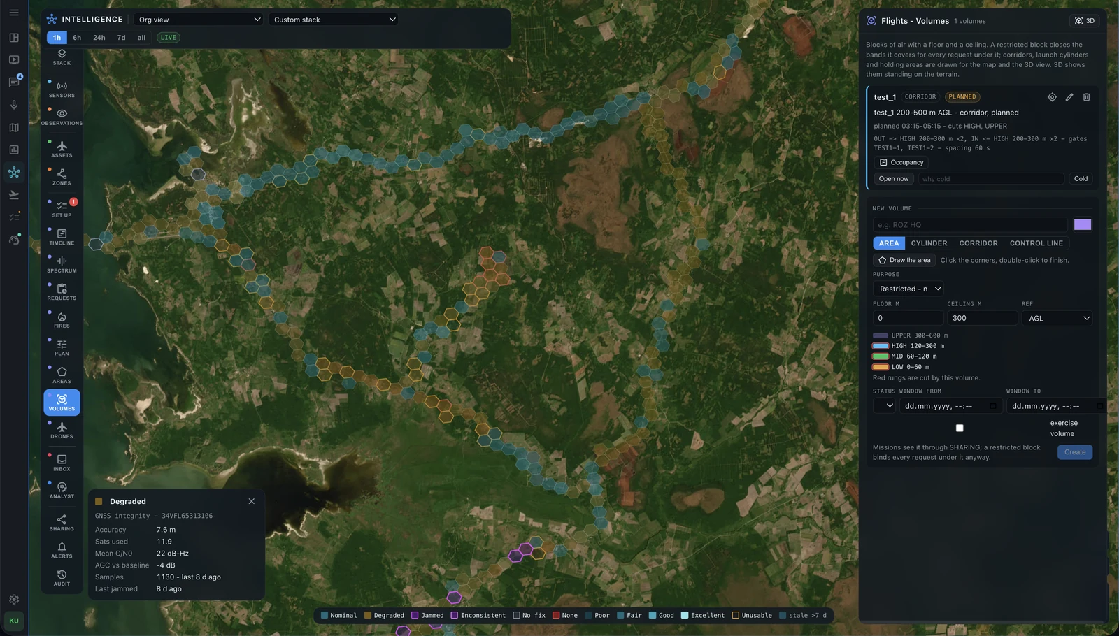
Actual ESTAK Intelligence view showing GNSS integrity zones and flight volumes
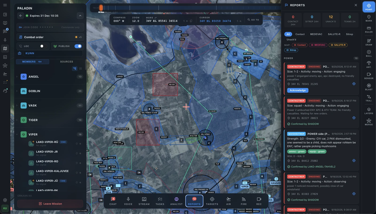
Actual ESTAK Reports interface with contact reports alongside the operational map
CONTACTREPONGOING

Contact report

20 September 2026 · 08:12:41

Size
1–2
Activity
Moving
Action
Engaging

Power 1 engaged enemy APC. APC destroyed, no friendly casualties.

⌖
MGRS LOCATION34V EL 76541 31245
Expanded from the report feed

01 / Live mapActual product captures · guided overview

SHARED PICTURETeams and data in context.
CONNECTEDMap, voice and video.
COORDINATEDTasks and field updates.
INTEGRATIONSStart with your existing tools.

Built for your mission

Three missions. One platform.

Military

Command the fight.

  • Tactical coordination
  • Team locations
  • Mission planning
  • Drone video
  • Voice communications
  • Task timelines
  • Contact reports and SITREPs
  • Operational intelligence
Explore Military

Law enforcement

See the operation. Coordinate the response.

  • Incident coordination
  • Team locations
  • Field video
  • Team assignments
  • Operational areas
  • Incident updates
  • Shared situational awareness
Explore Law enforcement

Private security

Protect people, sites and assets.

  • Control-room coordination
  • Personnel locations
  • Incident response
  • Patrol assignments
  • Site overview
  • Field video
  • Team communications
Explore Private security

The ESTAK platform

From sensor to decision.

Bring field information into a shared operational picture to support faster, better decisions.

DRONES

Video & imagery

CAMERAS

Static & mobile

RADIOS

Voice & PTT

VEHICLES

Position & telemetry

SATELLITES

Imagery & positioning

SENSORS

Field observations

TAK / EXTERNAL

Data exchange

AND MORE

Discuss your sources

ESTAK

CONNECT   /   ANALYZE   /   COORDINATE   /   ACT

BETTER
DECISIONS

Shared, real-time
understanding.

FASTER
RESPONSE

From information
to action.

SAFER
OPERATIONS

People, assets
and communities.

ANY SENSOR.   ANY TEAM.   ONE OPERATIONAL PICTURE.

Request a demo

One operational picture

SEE ESTAK IN ACTION.

Explore the actual ESTAK interface.

ACTUAL ESTAK INTERFACE

EXPLORE
BY TOPIC

A short visual tour of the ESTAK interface. Choose a topic to inspect the product screens, or request a guided demonstration.

SAME PLATFORM.
DIFFERENT MISSIONS.
Request a demo
CONNECT.
COORDINATE. ACT.

Connect your ecosystem

Connect the systems you rely on.

Plan how your devices, TAK tools and existing systems share information with ESTAK. Explore the integration requirements with us.

Explore integrations
TAK
ATAK
WinTAK
Drones
Radios
Sensors
Cameras
External systems

Intelligence in context

Observe. Understand. Act.

Read GNSS integrity and operational layers alongside the map. See where degraded positioning affects the picture.

Explore intelligence
GNSS integrity · selected observation

Degraded integrity
Reported accuracy: 7.6 m
Mean C/N0: 22 dB-Hz

Example from the product capture

Plan your deployment

Start with your
operating environment.

Discuss deployment

Connectivity

Network requirements

Hosting

Deployment options

Access

Roles and permissions

Devices

Field requirements

ESTAK interface

Open original ↗

Actual product capture. Use Zoom in to inspect labels, then scroll across the image.

Inside the platform

Explore the detail